
Historical Background of Chittoor District
The modern Chittoor district was formerly North Arcot District, which was established by the British in the 19th century. It had Chittoor as its headquarters. Chittoor district was constituted on 1 April 1911 with the taluks of Chittoor, Palamaner, and Chandragiri from Old North Arcot district of Tamilnadu, Madanapalle and Voyalpadu Taluks of Kadapa district and Ex-Zamindari areas of Pileru, Punganur, Srikalahasthi, Puttur and Old Karvetinagar estate. After the Indian independence in 1947, Chittoor region became a part of the erstwhile Madras state.
Following the implementation of the Pataskar Award on 1 April 1960, parts of Tiruthani Taluk were transferred to Tamil Nadu, while Sathyavedu Taluk with 186 villages was added to Chittoor District. Kuppam and Bangarupalem were later formed from villages transferred from Tamil Nadu and existing Chittoor areas, eventually becoming full-fledged taluks. In 1985, the district was reorganized into 66 revenue mandals, and on 4 April 2022, it was restructured into 31 mandals under 4 revenue divisions. After the formation of Annamayya and Tirupati districts from the erstwhile Chittoor district, Chittoor became predominantly rural and saw a reduction in major educational and healthcare institutions.
Water Management & Climate
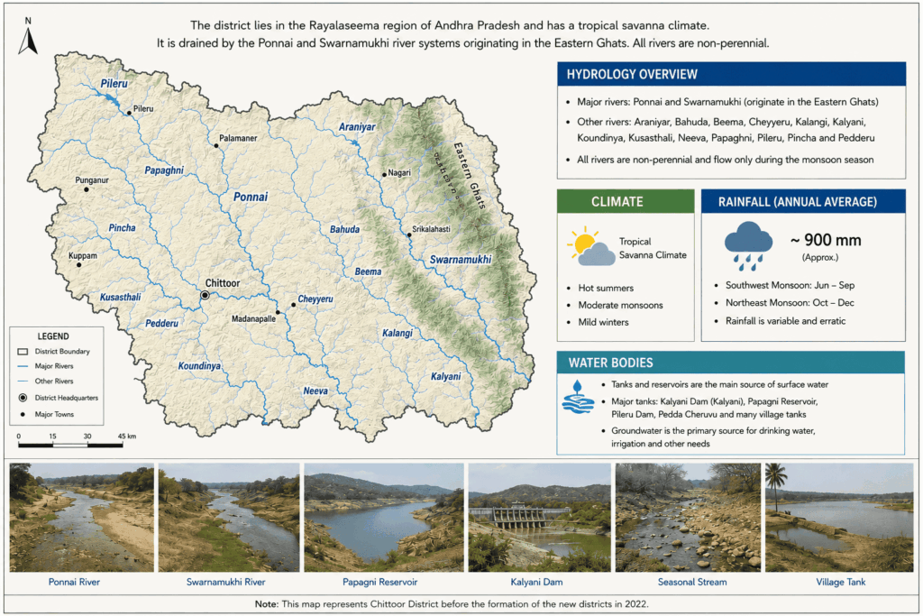
The important rivers in the district before restructuring were Ponnai and Swarnamukhi, which originate in the Eastern Ghats. Other rivers include Araniyar, Bahuda, Beema, Cheyyeru, Kalangi, Kalyani, Koundinya, Kusasthali, Neeva, Papaghni, Pileru, Pincha, and Pedderu. None of the rivers are perennial.
The western parts of Chittoor district, including Madanapalle, Punganur, Pileru, and Horsley Hills, experience cooler temperatures due to their higher elevation. Summer temperatures range between 36°C and 38°C in the west, while the eastern parts can reach up to 44°C. During winter, temperatures in the west fall to 12°C–14°C, compared to 16°C–18°C in the east. Most of the district has a tropical wet and dry climate, while some north-western areas experience a hot semi-arid climate. Undivided Chittoor district receives an average annual rainfall of 918.1 mm, mainly from the South West Monsoon (438.0 mm) and North East Monsoon (396.0 mm). The district recorded 984.2 mm rainfall in 2002 and 934.0 mm in 2003.
District Overview
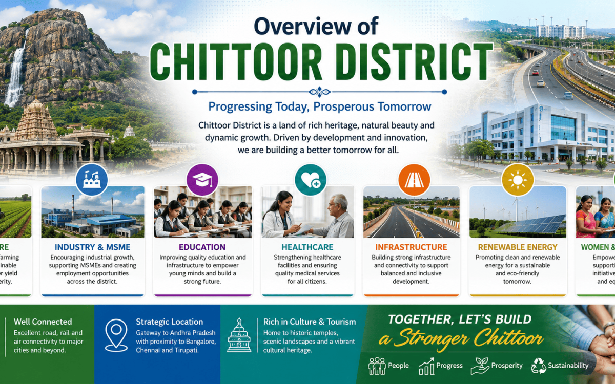
Chittoor District, located in the southern part of Andhra Pradesh, is a region renowned for its rich cultural heritage, thriving agriculture, industrial growth, and spiritual significance.
Key Highlights
State : Andhra Pradesh.
District Headquarters: Chittoor.
Region: Rayalaseema.
Major Crops: Mango, Tomato, Sugarcane, Groundnut, Millets.
Key Industries: Dairy, Food Processing, Manufacturing, MSMEs.
Tourism: Temples, Forts, Waterfalls, Heritage Sites.
Connectivity: Well-connected by road, rail, and nearby airports.
Education: Growing network of schools, colleges, and professional institutions.
Healthcare: Expanding healthcare infrastructure and medical facilities.
Development Focus: Agriculture, Infrastructure, Renewable Energy, Social Welfare.
Quick Facts About Chittoor District
Area
6860 Sq. Km.
Population
18,73,000
Languages
Telugu, Tamil, Urdu
GDP
₹40,409 crore
Agriculture Sector
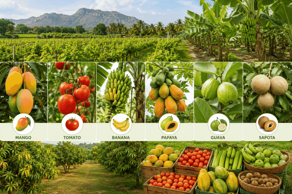
Chittoor District has a diverse landscape of plains, valleys, and hills, with predominantly red loamy soils along with patches of black cotton and sandy loam soils, making it suitable for a wide range of agricultural activities. Major crops cultivated in the district include paddy, groundnut, sugarcane, maize, millets, pulses, and cotton, with groundnut being one of the most extensively grown rain-fed crops.
Chittoor is one of Andhra Pradesh’s leading horticultural districts, known for large-scale production of mango, tomato, banana, papaya, guava, and sapota. The district is particularly famous for its extensive mango orchards, which support fruit processing industries and contribute significantly to exports. Chittoor district has a strong agricultural marketing network with regulated markets, storage facilities, and processing units. The district is known for mango and tomato processing industries, while farmers increasingly adopt modern practices such as drip irrigation, precision farming, and organic cultivation, supported by government initiatives for sustainable agriculture.
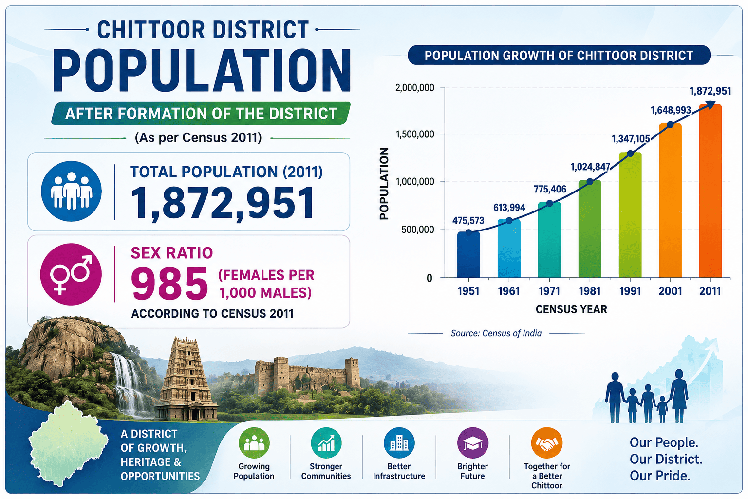
| Indicator | Statistics |
|---|---|
| Total Population | 1,872,951 |
| Male Population | 943,555 |
| Female Population | 929,396 |
| Sex Ratio | 985 females per 1,000 males |
| Population Density | 275 persons per sq. km |
| Literacy Rate | 72.36% |
| Urban Population | Approximately 31% |
| Rural Population | Approximately 69% |
Population Statistics
Revenue Divisions In Chittoor District
Overview Of Major Towns
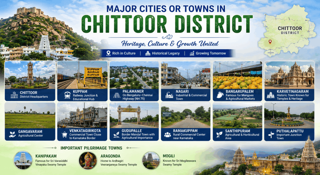
Chittoor district is home to several important towns. Chittoor is known for its mango trade and granite industries, Kuppam is a key railway and commercial hub, and Madanapalle is renowned for its tomato market, mango cultivation, and pleasant climate. The district acts as a agricultural hub for the neighboring states.
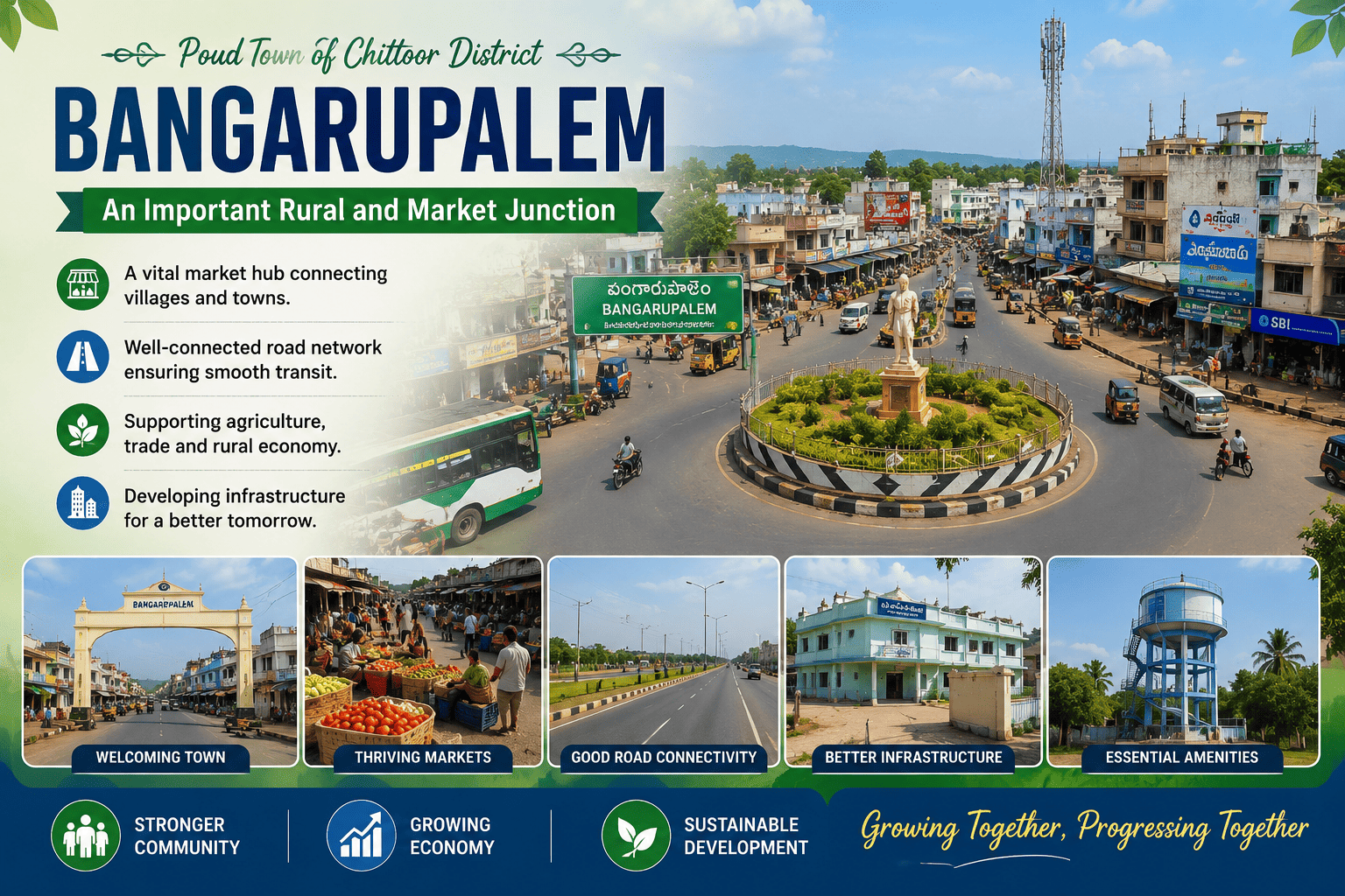
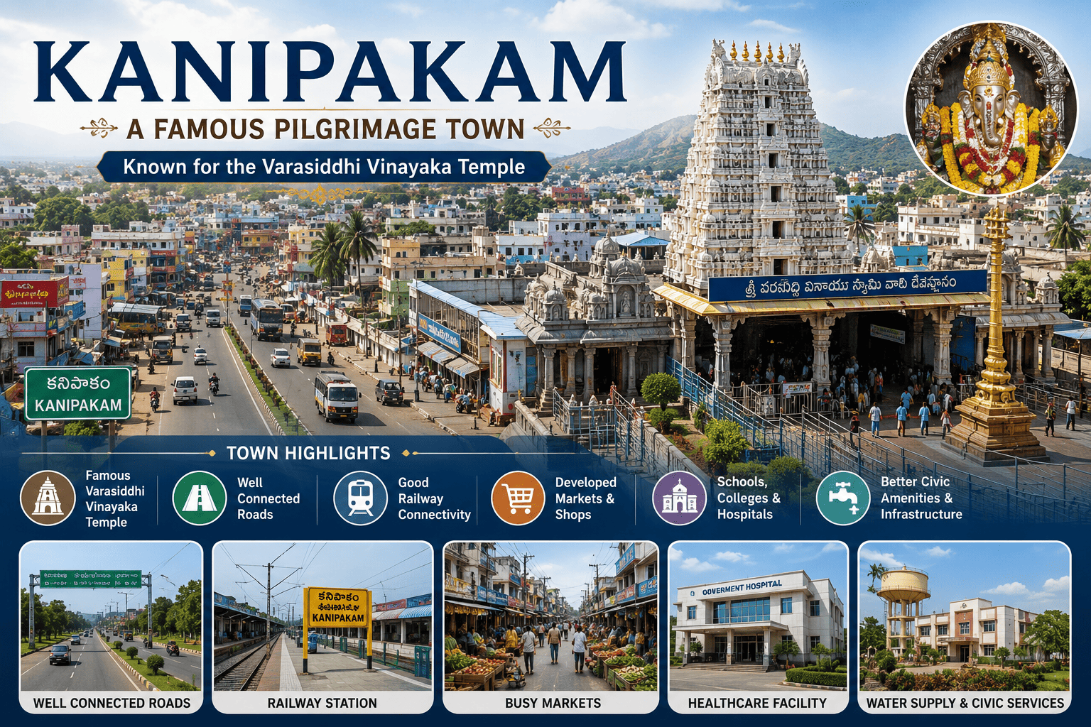
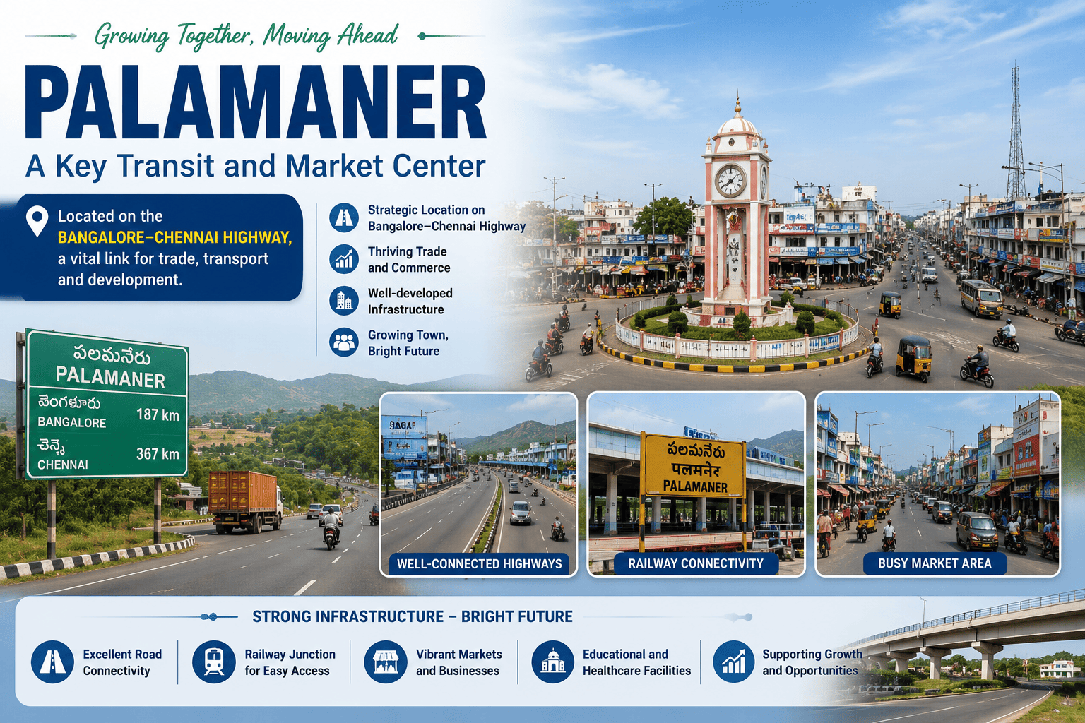
Punganur is famous for its unique Punganur dwarf cattle breed and strong agricultural activities, while Nagari is an important industrial and commercial center near the Tamil Nadu border. Palamaner serves as a key transit and trade hub along the Bengaluru–Chennai highway, and Puttur is renowned for its traditional bone-setting practices. Bangarupalem is a significant market town supporting agricultural commerce, while Kanipakam is a major pilgrimage destination known for the revered Sri Varasiddhi Vinayaka Temple.
Chittoor
| Category | District Headquarters |
| Economy | Government administration and public services, Agriculture and horticulture, Dairy and poultry industries, Education |
| Revenue | Property Tax, Water Supply Charges, Advertisement Tax, State Government Grants |
| Area | 95.97 km2 |
| Population | 2.28 Lakhs |
| Budget | ₹338.87 Crore |
| Known For | Pilgrimage Destinations |
| Tourist Places | Kanipakam Varasiddhi Vinayaka Temple |
| Special Feature | Civic Infrastructure, Smart Urban Services |
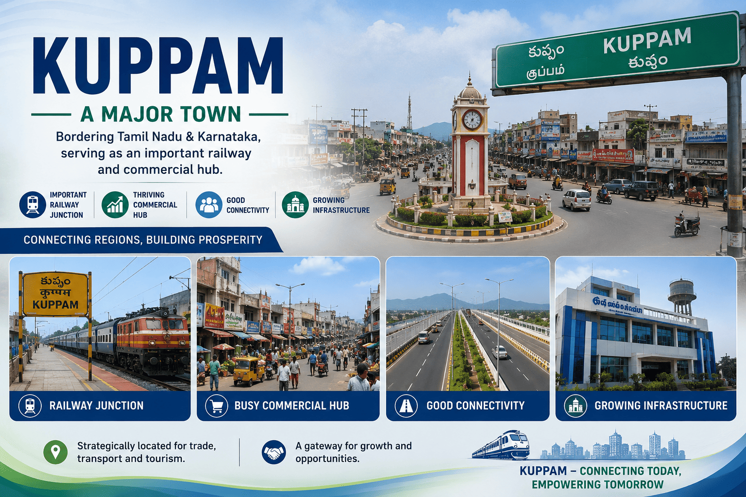
Kuppam
| Category | Educational Hub, Railway Junction |
| Economy | Government administration and public services, Agriculture and horticulture, Dairy and poultry industries, Education |
| Revenue | Property Tax, Water Supply Charges, Building Permissions, State Government Grants |
| Area | 3.10 km2 |
| Population | 21,963 |
| Budget | ₹20–30 crore |
| Known For | Kuppam Green Granite |
| Tourist Places | Granite landscapes, Rural eco-tourism destinations |
| Special Feature | Border Trade Center, Granite Export |
Palamaner
| Category | Agriculture, Horticulture Town |
| Economy | Agriculture and horticulture, Dairy and poultry industries, Small Scale Industries |
| Revenue | Property Tax, Water Charges, Trade Licenses, State Government Grants |
| Area | 17.69 sq. km |
| Population | 54,035 |
| Budget | ₹9–10 crore |
| Known For | Silk Production, Tomato & Mango Cultivation |
| Tourist Places | Koundinya Wildlife Sanctuary |
| Special Feature | Surrounded by forests, hills, and agricultural landscapes |
Nagari
| Category | Commercial, Transport Town |
| Economy | Small Scale Manufacturing, Agriculture Markets |
| Revenue | Property Tax, Water Charges, Trade Licenses, State Government Grants |
| Area | 35.45 sq. km |
| Population | ~62,253 |
| Budget | No Official Data |
| Known For | Granite Industry, Mango Cultivation |
| Tourist Places | Sri Shirdi Sai Divyadhamam |
| Special Feature | Nagari Nose Hill |
Bangarupalem
| Category | Agriculture Town |
| Economy | Agriculture, Poultry, Dairy Farming |
| Revenue | Local Taxes, Market Fees, State Government Grants |
| Population | ~6500 |
| Budget | ₹22–40 crore Annually |
| Known For | Tomato Cultivation, Mango Orchards |
| Tourist Places | Mogili Temple |
| Special Feature | Mango Plantations, Agricultural Markets |
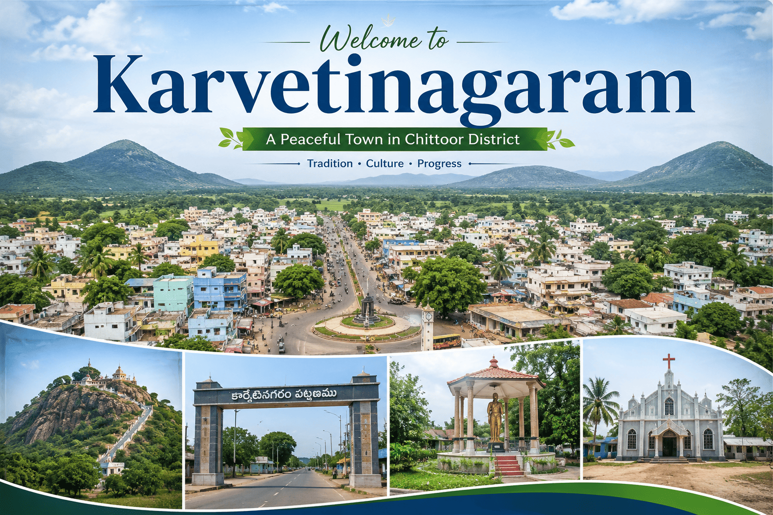
Karvetinagaram
| Category | Temple Town |
| Economy | Agriculture, Dairy Farming, Small Retail Businesses |
| Revenue | ₹6–9 Crore Annually |
| Area | 14.24 km² |
| Population | 11,000–13,000 |
| Budget | ₹7–10 crore Annually |
| Known For | Beautiful Dravidian architecture, Traditional temple festivals |
| Tourist Places | Venugopalaswamy Temple |
| Special Feature | Karvetinagaram Zamindari |
Gangavaram
| Category | Agricultural Town |
| Economy | Agriculture, Dairy Farming, Rural Markets |
| Revenue | ₹2–4 Crore Annually |
| Area | 1,096 hectares |
| Population | 7,183 |
| Budget | ₹4–8 Crore Annually |
| Known For | Fertile Agricultural Lands, Dairy Farming |
| Tourist Places | Scenic countryside and forest landscapes |
| Special Feature | Agricultural hub with scenic forest surroundings |
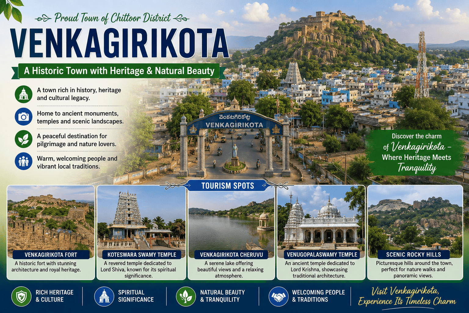
Venkatagirikota
| Category | Agricultural Town |
| Economy | Agriculture, Dairy Farming, Rural Markets |
| Revenue | No Official Data |
| Area | 306 km² |
| Population | 12,803 |
| Budget | No Official Data |
| Known For | Agricultural produce markets, Tomato and mango cultivation |
| Tourist Places | Scenic rural landscapes around V. Kota |
| Special Feature | Important gateway connecting three South Indian states |
Gudupalle
| Category | Agricultural Town |
| Economy | Agriculture, Dairy Farming, Flowers, Vegetables |
| Revenue | No Official Data |
| Area | 306 km² |
| Population | 3850 |
| Budget | No Official Data |
| Known For | Agricultural produce markets, Multilingual cultural heritage |
| Tourist Places | Rural temples and picturesque countryside landscapes |
| Special Feature | Fertile red-soil agricultural belt supporting diverse crops |
Ramakuppam
| Category | Agricultural Town |
| Economy | Agriculture, Dairy Farming, Flowers, Vegetables |
| Revenue | No Official Data |
| Area | 5.58 sq. km |
| Population | ~6,291 |
| Budget | No Official Data |
| Known For | Productive agricultural landscape, Peaceful rural environment |
| Tourist Places | Scenic farmlands and hill landscapes surrounding Ramakuppam |
| Special Feature | Pleasant climate due to its relatively high elevation |
Santhipuram
| Category | Agricultural Town |
| Economy | Agriculture, Dairy Farming, Retail & Inter State Trade |
| Revenue | No Official Data |
| Area | No Data |
| Population | 61,789 (Entire Mandal) |
| Budget | No Official Data |
| Known For | Border trade, Horticulture, Mango cultivation |
| Tourist Places | Local village temples and surrounding countryside offering traditional rural experiences |
| Special Feature | Peaceful environment with scenic farmlands and traditional village culture |
Puthalapattu
| Category | Agricultural Town |
| Economy | Agriculture, Dairy Farming, Retail & Inter State Trade |
| Revenue | No Official Data |
| Area | 10.65 sq. km |
| Population | 5,583 |
| Budget | No Official Data |
| Known For | Agricultural production and rural markets, Educational Institutions |
| Tourist Places | Nearby rural temples and scenic agricultural landscapes |
| Special Feature | Strategic location on NH-140, linking Chittoor and Tirupati |
Gangadhara Nellore
| Category | Agricultural Town |
| Economy | Paddy, Groundnut, Mango Orchards, Tomato Farming |
| Revenue | No Official Data |
| Area | 11.2 sq. km |
| Population | 4,444 |
| Budget | No Official Data |
| Known For | Fertile agricultural lands, Mango and paddy cultivation |
| Tourist Places | Local village temples and traditional festivals |
| Special Feature | Important agricultural hub of central Chittoor district |
Yadamari
| Category | Agricultural Town |
| Economy | Paddy, Groundnut, Mango Orchards, Tomato Farming |
| Revenue | No Official Data |
| Area | ≈ 11.76 sq. km |
| Population | 7,584 |
| Budget | No Official Data |
| Known For | Fertile agricultural lands, Mango and paddy cultivation |
| Tourist Places | Local village temples and traditional festivals |
| Special Feature | Strong agricultural base with growing horticulture |
Gudipala
| Category | Agricultural Town |
| Economy | Paddy, Groundnut, Mango Orchards, Tomato Farming |
| Revenue | No Official Data |
| Area | 190 sq. km (Entire Mandal) |
| Population | 43,306 (Entire Mandal) |
| Budget | No Official Data |
| Known For | Fertile agricultural lands, Mango and paddy cultivation |
| Tourist Places | Local village temples and traditional festivals |
| Special Feature | Strong agricultural economy with expanding residential development |
Baireddipalle
| Category | Agricultural Town |
| Economy | Paddy, Groundnut, Mango Orchards, Tomato Farming |
| Revenue | ₹2–4 Crore |
| Area | 18 km² |
| Population | 7,225 |
| Budget | ₹8–15 Crore |
| Known For | Groundnut and millet cultivation, Mango orchards |
| Tourist Places | Local temples and scenic agricultural landscapes around Baireddipalle |
| Special Feature | Rich red-soil farmlands suitable for horticulture |



District Geography
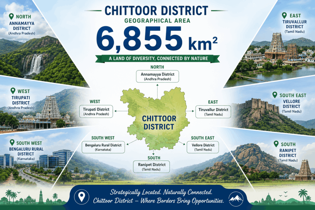
Chittoor district is located in the southern part of Andhra Pradesh and serves as a gateway connecting the states of Andhra Pradesh, Tamil Nadu, and Karnataka. Covering a geographical area of approximately 6,855 square kilometres, the district is characterized by diverse landscapes, including fertile plains, rolling hills, forested regions, rivers, and agricultural lands. The district features a blend of rocky hills, valleys, forests, and agricultural fields.
Boundaries of Chittoor District
- North: Annamayya District
- West: Tirupati District
- South-West: Bengaluru Rural District
- East: Tiruvallur District
- South-East: Vellore District
- South: Ranipet District
District Economy
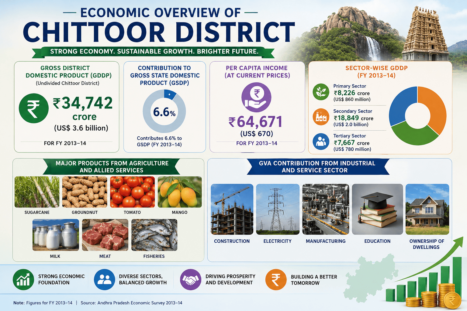
The district’s economy is driven by all three major sectors. The primary sector, which includes agriculture and allied activities, plays a vital role in rural livelihoods and contributes significantly to the local economy. The secondary sector is supported by manufacturing, electricity generation, food processing, and construction activities. The tertiary sector, comprising education, trade, transportation, real estate, and other services, has emerged as a major contributor to economic development.The Gross District Domestic Product (GDDP) of the undivided district for FY 2013-14 is ₹34,742 crore (US$3.6 billion) and it contributes 6.6% to the Gross State Domestic Product (GSDP). For the FY 2013–14, the per capita income at current prices was ₹64,671 (US$670). The primary, secondary and tertiary sectors of the district contribute ₹8,226 crore (US$860 million), and ₹18,849 crore (US$2.0 billion) respectively.[18] The major products contributing to the GVA of the district from agriculture and allied services are, sugarcane, groundnut, tomato, mango, milk, meat and fisheries. The GVA to the industrial and service sector is contributed from construction, electricity, manufacturing, education and ownership of dwellings.